Para District (Distrikt Para)
Para is a district of northern Suriname. Para's capital city is Onverwacht, with other towns including Paranam, and Zanderij. Para has a population of 24,700 and an area of 5,393 km2. The district is the mining and forestry centre of Suriname, with many large bauxite mining operations operating. The district is a mixture of forest and savannas.
The northern part of Para is one of the oldest cultivated areas of Suriname, and has been home to sugar and tobacco plantation since the 17th century which were mainly located along the Suriname River and the Para Creek. The southern part of the district contained wood plantations, and is still in use by logging companies. In 1968, the District was established, and named after the Para Creek. In 1983, the District was quadrupled in size.
The district used to be accessible only by boat. The discovery of gold in Brokopondo and Sipaliwini lead to the construction of the Lawa Railway and growth of the villages next to the railway line. The railway line was decommissioned in 1986.
During World War II American troops were stationed in Suriname. The existing airport at Zorg en Hoop was insufficient, and the airstrip at Zanderij, was upgraded to a major airport. In 1936, a road, currently named Indira Gandhiweg, had been built parallel to the railway line to connect Paramaribo with Onverwacht, which was extended to the airport. In the 1960s, the Afobakaweg was constructed to provide access to the south of the country.
The ruins of the city of Jodensavanne are in Para district. Jews fleeing the Spanish Inquisition established Jodensavanne in the 17th century, but it was destroyed in 1832 by a fire. Jodensavanne was an internment camp for suspected Nazi supporters from the Dutch East Indies during the Second World War.
Para is home to several indigenous villages from the Carib and Arawak tribes.
Map - Para District (Distrikt Para)
Map
Country - Suriname
 |
 |
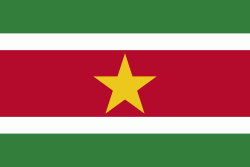
| Flag of Suriname | |
It has a population of approximately, dominated by descendants from the slaves and labourers brought in from Africa and Asia by the Dutch Empire and Republic. Most of the people live by the country's (north) coast, in and around its capital and largest city, Paramaribo. It is also one of the least densely populated countries on Earth. Situated slightly north of the equator, Suriname is a tropical country covered in rainforests. Its extensive tree cover is vital to the country's efforts to mitigate climate change and maintain carbon negativity. A developing country with a relatively high level of human development, Suriname's economy is heavily dependent on its abundant natural resources, namely bauxite, gold, petroleum, and agricultural products.
Currency / Language
| ISO | Currency | Symbol | Significant figures |
|---|---|---|---|
| SRD | Surinamese dollar | $ | 2 |
| ISO | Language |
|---|---|
| NL | Dutch language |
| EN | English language |
| JV | Javanese language |


